An Operational Perspective
By Jeff Goodrich, Glacier National Park
Note: This article was originally published in The Avalanche Journal, Volume 129, Spring 2022

MY SMARTPHONE CHIMES notifying me I have a new text message. It’s an automatic alert from the avalanche detection network in Glacier National Park, British Columbia. The message: an avalanche just occurred in the Gunners/Mannix sector of the park.
Avalanche activity has been picking up in the last few hours but visibility has been poor all day and it’s been difficult to see what’s happening on the ground. I check our web platform and see the avalanche initiated in Gunners #1 slide path and stopped well above the road. This latest alert still fits with my current assessment of gradually rising avalanche hazard and the need for avalanche control later this evening. If the detection network showed the avalanches getting too close to the road, I might have needed to consider an earlier start for avalanche control work. For now, the detected activity is consistent with what is typically seen leading up to a road closure and avalanche control. I continue planning the shoot and wait to see what the next detection might tell me. A relatively new addition to the suite of avalanche forecasting and control tools in Rogers Pass, the avalanche detection network (ADN) is proving its worth.
Over the past five years, the ADN has been delivering real-time data to Glacier National Park’s Avalanche Control Section. This information is used to assist with operational decision-making. This article looks at my experience with the network in Rogers Pass and how the avalanche control team is incorporating this information into daily operations.
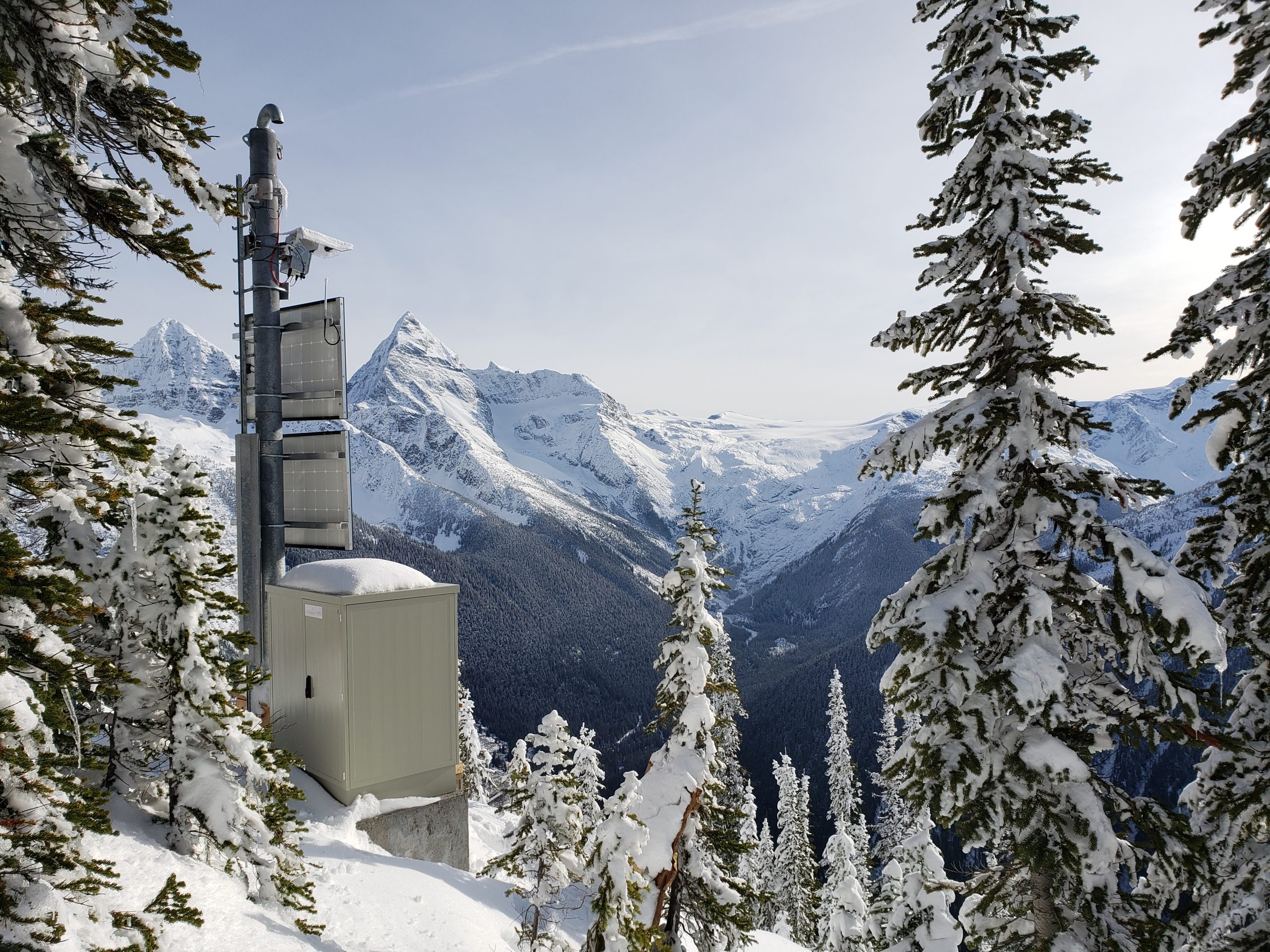
The ADN in Glacier National Park was one of a number of avalanche mitigation projects realized through the Government of Canada’s Federal Infrastructure Investment Program. ADNs were initially proposed as one of the measures to improve the reliability of the Trans-Canada Highway in winter in a study by the BC Ministry of Transportation and Infrastructure. Parks Canada contracted McElhanney Engineering and Dynamic Avalanche Consulting to assess the feasibility of an extensive ADN in Rogers Pass and to develop a request for proposals. Wyssen Avalanche Control was the successful bidder to design, supply, and install the network. What started as a pilot project in 2016-17 with one detector, now consists of 13 infrasound arrays (IDAs), four doppler radar installations (LARAs), one short-range radar (SARA), one laser scanner (LIA), and an integrated web-based platform (WAC.3). This project represents the largest avalanche detection network in the world.
HOW THE ADN WORKS
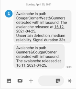
When the ADN picks up avalanche activity, it sends out notifications. Text messages are the go-to method of receiving the first alert that an avalanche has occurred. Email notifications are also available, but texts are generally found to be more immediate and are received within minutes of an avalanche being detected on our smartphones or tablets. I have even received text notifications before being able to see the
avalanche coming over a snowshed during avalanche control at night. Alerts are received for all forms of detection and the message includes the group of avalanche paths covered by the infrasound detection, the “reliability” or confidence of the detection, and the time and date of the detection.
In Glacier National Park, the IDAs generally pick up size 2 avalanches and greater; however, the position of the sensor array in relation to the individual avalanche path and the terrain characteristics in the area can increase or decrease the minimum size of the avalanche detected. A sensor array close to an avalanche path with no intervening terrain will detect smaller avalanches than a sensor farther away with terrain shadowing the avalanche path. Signals from large avalanches are not as affected by terrain and are usually well detected, with multiple arrays making detections.
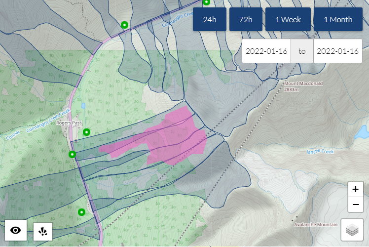
After the initial alert is received, we can look at the WAC.3 web platform to get more detailed information on the detection to help us interpret what is going on. The platform displays a map of the area with the outlines of our avalanche paths. The locations of the IDA and LARA detectors are also on the map and any avalanche detections are displayed. The default view shows the last 24 hours; however, any time or date range can be selected.
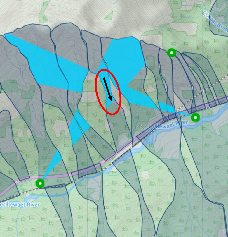
The IDA detections are displayed on the map as a triangle radiating out from the detector. One leg of the triangle indicates the direction where the avalanche signal was picked up and the other leg indicates the direction where the avalanche signal was no longer heard. When two or more IDAs detect the same event and their triangles overlap, the avalanche can be localized to a single avalanche path. If the avalanche is detected with only a single IDA, the avalanche can only be localized if the detection points to a single path. For single IDA detections that cross multiple paths, the individual avalanche path may not be localized, but useful information can still be gained about how far the avalanche ran.
LARA dectections from the doppler radar are usually easy to interpret and can give a good rendering of the avalanche when properly calibrated and working well. The SARA and LIA detectors are located on the Wyssen avalanche control towers and detect if an avalanche was triggered from remote explosive control.
The transportation corridor in Glacier National Park through Rogers Pass has 135 avalanche paths that have the potential to affect the highway or railway. Having good situational awareness of avalanche activity in the transportation corridor is key for creating avalanche assessments and timing avalanche control activities. Visibility, in terms of weather, daylight, and geographic area, can hinder the ability of avalanche forecasters to obtain accurate and timely avalanche observations. The ADN has been found to greatly assist the team in decision-making and it continues to be incorporated into daily operations.

DAILY OPERATIONS
ADN information from the overnight period is incorporated into our morning avalanche assessments on a daily basis. Having an indication of overnight avalanche activity—or lack of activity—is an asset first thing in the morning, before avalanche forecasters have had a chance to get out and visually look for any new avalanches. This information can give us greater confidence in our decisions and assessments as we prepare for the day’s operations.
During the operational day, the detection network can help us target our patrols in terms of timing and geographical area. When visibility is poor, it helps us focus in and pick out events we might have missed otherwise. This greatly assists with the forecasters’ situational awareness and can give an early alert to deteriorating avalanche conditions.
Every night during the winter, Glacier National Park has a duty forecaster on call who may need to give advice for work or incident management in avalanche zones along the highway. Having the detection network as an additional tool gives increased confidence in making these decisions. Before installing the ADN, we would set alarms on weather telemetry as a proxy for when avalanches might be running or conditions were changing. Now, we also have reliable alerts on the avalanches themselves.
AVALANCHE CYCLE AND CONTROL
Going into an avalanche cycle and timing control activities is always an intense and stressful period. During this time, we watch the ADN closely to help us with closure timing and alert us to changing conditions. In the pre-shoot phase, we monitor rising hazard to ensure the closure timing and avalanche control strategy are still reasonable or if we need to make adjustments. In this phase, the forecaster is monitoring the frequency of avalanche activity and how far the avalanches are running. Traditionally, darkness, poor visibility, and the limitations to being out on the road have been challenges. With the aid of the ADN, the forecaster can remotely monitor avalanche activity and follow up if any significant events are detected.
During the shoot, which is often at night or in the middle of a storm, assessing the results can be difficult due to visibility, environmental conditions, or the character of the avalanches. The detection network can either confirm a lack of results or that avalanches are indeed running, but unseen. This is very valuable information the forecaster can use when deciding how many or few targets to shoot.
Another valuable use of the network during avalanche control is to monitor avalanche activity in other areas of the transportation corridor outside of where active control is taking place. For example, the highway may be closed while we are shooting in our east block, but traffic is still flowing through our west block. Avalanche activity can be monitored remotely in the west to determine if and when a preventive closure may be required in that area.
After the shoot, especially if it is at night, it is beneficial to have the confirmation of a lack of avalanche activity from the detection network. This gives confidence in the effectiveness of the control or, alternatively, it can give an alert to changing conditions if detections are starting to increase in the post-control period. The next day, we can review all the detections throughout the avalanche cycle to help us compile our database record of shoot results and natural activity. Reviewing the detections can also help assess the risk reduction to the transportation corridor on a path-by-path basis by indicating avalanche events that may have been obscured by snowfall or subsequent avalanches.
CHALLENGES AND OPPORTUNITIES
One challenge is the sheer amount of information forecasters are receiving during busy times such as an avalanche cycle with control operations. During a shoot, the forecaster is directing the artillery, observing avalanches, deciding on targets, and moving to the next observation location. Often, as the text alerts come in, the forecaster does not have time to look at them all and follow up on the web platform. Having a second forecaster to check the detections can be a big help.
A small number of false alarms have also been seen. Though not enough to degrade the overall performance of the system, Wyssen is looking at ways to filter these out. For example, several false alarms from the doppler radar sensors may be attributed to weather effects meeting the radar’s threshold to classify them as avalanches. The false alarm can often be recognized in the WAC.3 interface by looking at the heat map of the detection, which does not look like the outline of an avalanche. With the infrasound sensors, we have had a recurring false alarm that points to the portal of a snowshed, presumably from vehicles or strong winds. The ADN also detects when the howitzers are fired but has picked up a number of false gun firing detections, most likely from train and traffic noise.
One area of opportunity is to better understand the effects of terrain on avalanche detection. It seems that some avalanche events are more easily detected in certain paths than others. Having a better understanding of how the characteristics of each path affect the infrasound signal would help us better interpret the information the detection network is providing. The goal is to follow up and continue to tune and refine the resolution of the avalanche detection.
CONCLUSION
The avalanche detection network has been found to be immediately useful and beneficial in helping Parks Canada’s Avalanche Control Section do its job. I personally appreciated the data provided to assist with critical decisions and it has been embraced enthusiastically by our forecasting team. Getting real-time information when avalanches are running is a huge benefit to reducing uncertainty in our hazard
assessments and increasing our situational awareness.
The ADN helps us make decisions that impact avalanche control operations and any other work that takes place in Glacier National Park’s avalanche zones. The results of this project have helped increase the safety to the public and to our team members, and the reliability of the Trans-Canada Highway in winter.

